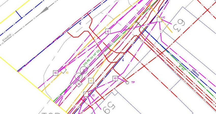
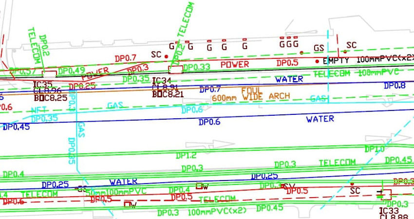
Utility Survey & Mapping
Utility Survey and Mapping is the process of identifying and labelling public utility mains that are underground. These mains may include lines for telecommunication, electricity distribution, natural gas, cable television, fibre optics, traffic lights, streetlights, storm drains, water mains, and wastewater pipes.